Tourist Sites Near Me – Best Places to Visit Nearby
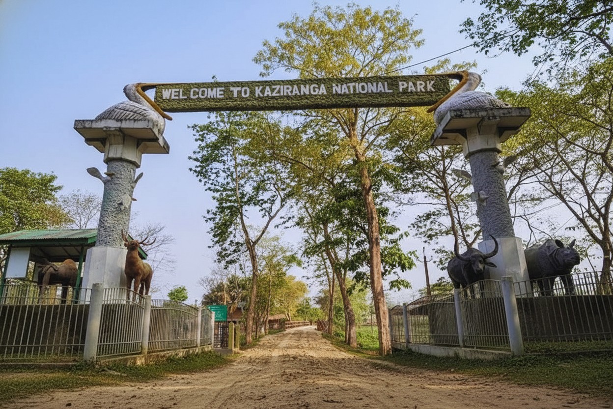
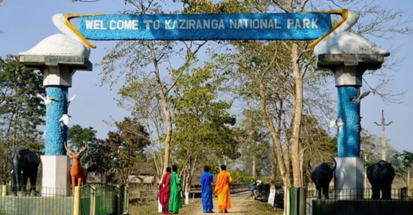
Kaziranga national park
Bokakhat (nearest town) • Golaghat, Nagaon & Karbi Anglong • Assam
Kaziranga National Park is one of India's most famous wildlife sanctuaries and a UNESCO World Heritage Site located in the state of Assam. Spread across the floodplains of the mighty Brahmaputra River, the park is renowned for hosting the world's largest population of the endangered Indian one-horned rhinoceros. Rich grasslands, wetlands, forests, and diverse wildlife make Kaziranga a paradise for nature lovers, photographers, and wildlife enthusiasts.
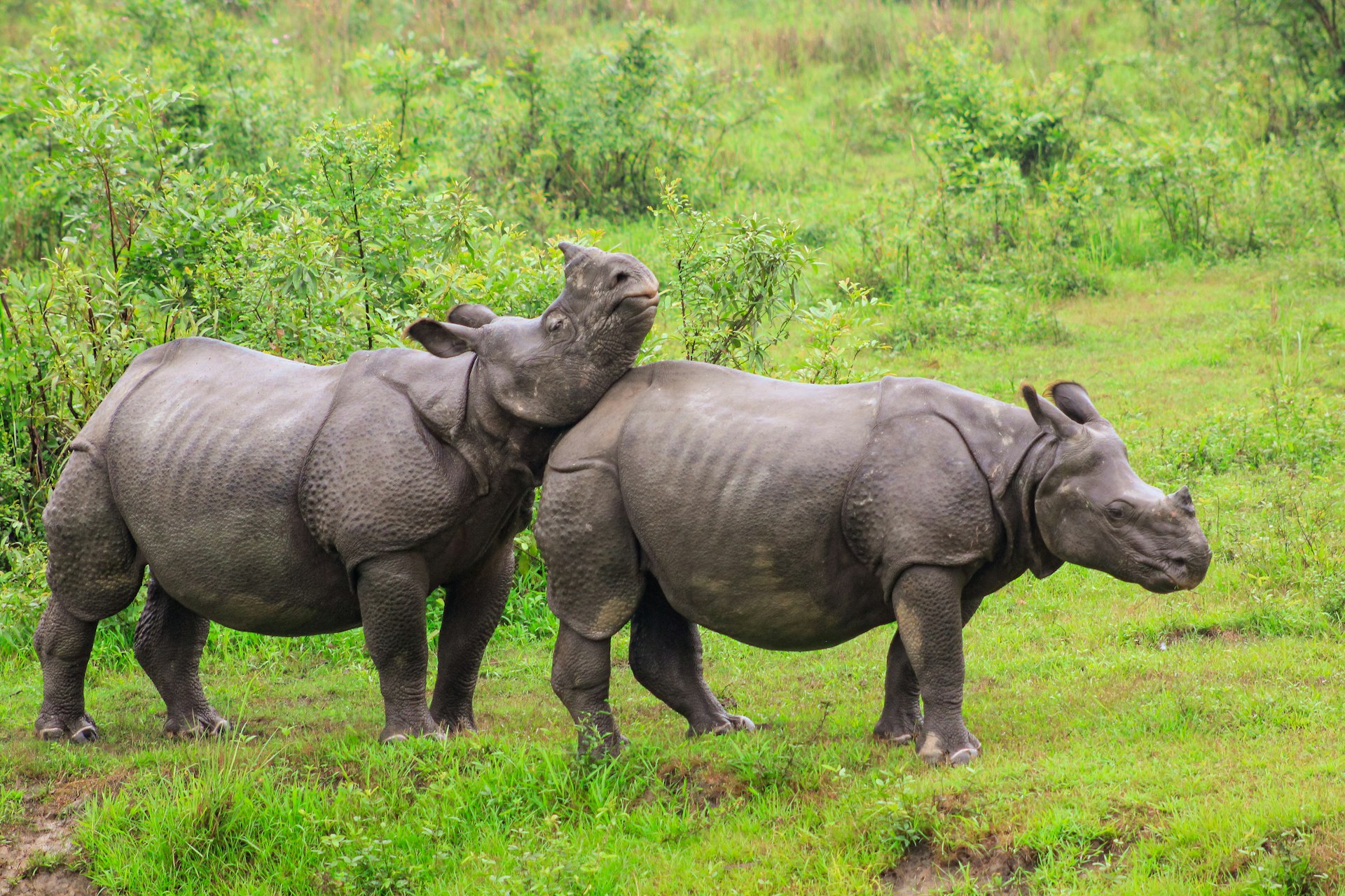
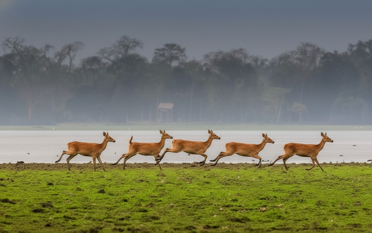
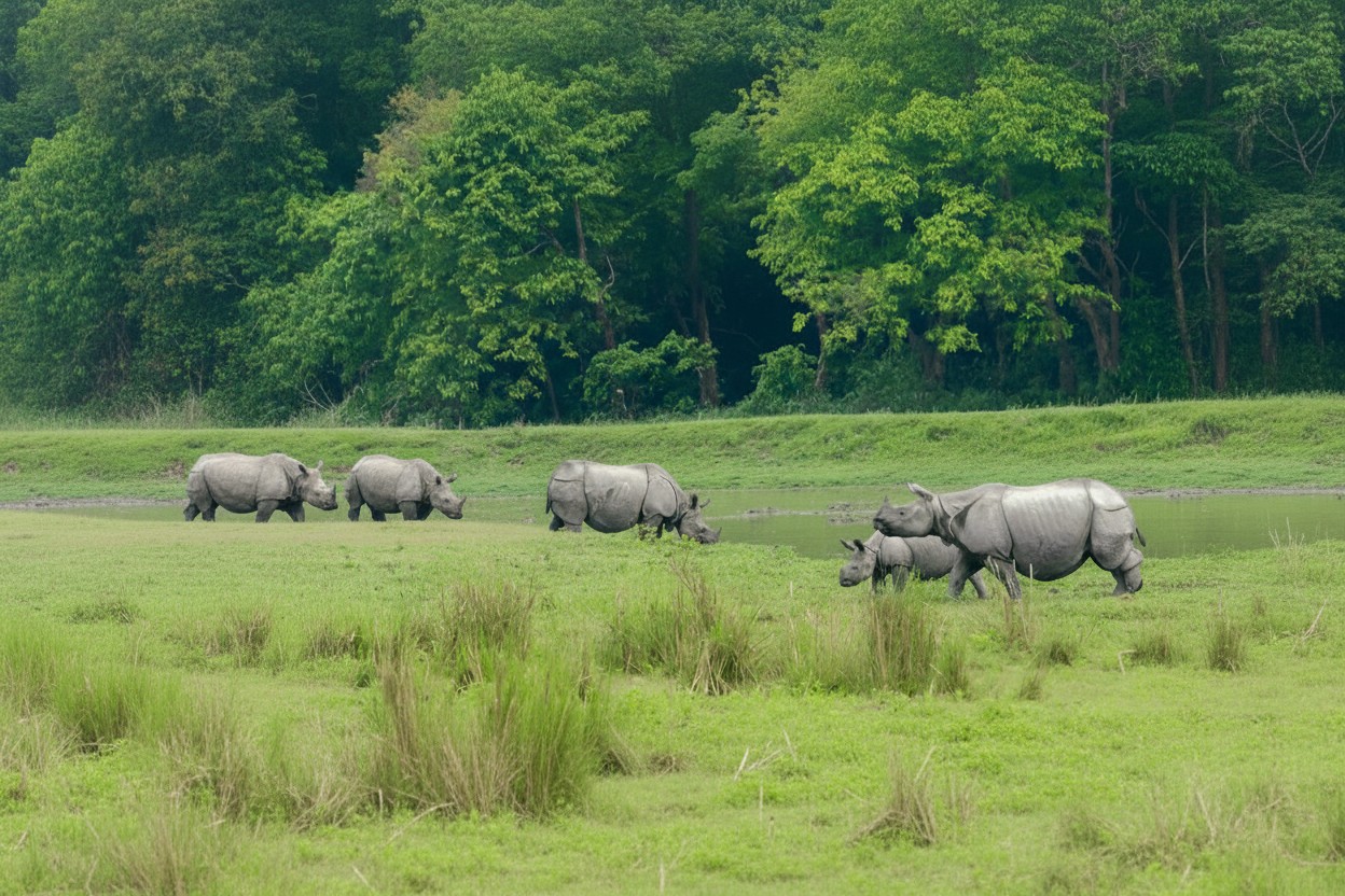
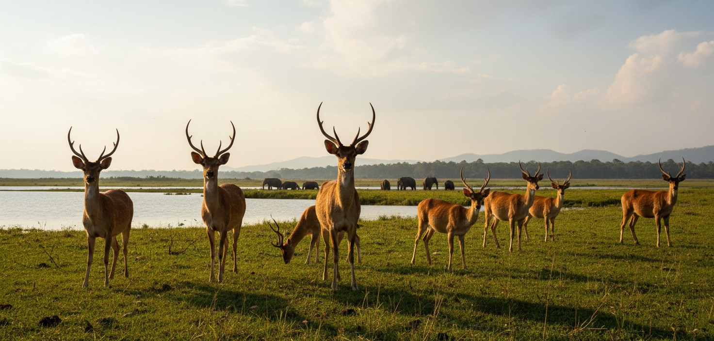
Kaziranga National Park is one of India's most celebrated wildlife destinations and a symbol of successful conservation efforts. Located in Assam along the banks of the Brahmaputra River, the park covers vast stretches of grasslands, marshes, and tropical forests. It is internationally recognized for protecting the endangered Indian one-horned rhinoceros and is home to the largest population of this magnificent animal in the world. Established as a protected area in 1905, Kaziranga has evolved into a thriving ecosystem supporting a remarkable variety of wildlife. Visitors can spot Bengal tigers, Asian elephants, wild water buffaloes, swamp deer, and many other mammals during safari excursions. The park is also a haven for birdwatchers, with hundreds of resident and migratory bird species inhabiting its wetlands and forests.
The natural beauty of Kaziranga is equally captivating. Expansive grasslands sway in the breeze, while numerous water bodies attract wildlife throughout the year. The annual flooding of the Brahmaputra River enriches the soil and sustains the park's unique ecological balance, creating ideal conditions for diverse flora and fauna.
Jeep safaris and elephant safaris offer visitors close encounters with wildlife in their natural habitat. Early morning excursions often provide the best opportunities for animal sightings and photography. The park's well-managed tourism facilities make it accessible and enjoyable for families, nature enthusiasts, and adventure seekers alike.
Recognized as a UNESCO World Heritage Site, Kaziranga National Park stands as a shining example of wildlife conservation in India. Its extraordinary biodiversity, stunning landscapes, and iconic rhinoceros population make it a must-visit destination for anyone seeking an unforgettable experience in the heart of nature.
🎯 Things to do
- Jeep Safari (Central
- Western
- Eastern & Burapahar Ranges)
- Elephant Safari (Best for close rhino sightings)
- Bird Watching (Migratory and wetland birds)
- Wildlife Photography
- Visit Kaziranga Orchid & Biodiversity Park
- Nature Walks (outside core zones)
- Local Assamese Cultural Experience .
📍 Near By
- Kakochang Waterfalls (≈13 km)
- Karbi Anglong Hills
- Kaziranga Orchid Park
- Panbari Reserve Forest
- Brahmaputra River Viewpoints
- Numaligarh Tea Estates
- Numaligarh Refinery & Heritage Village..
🛣️ How to Reach
By Air :-The nearest airport is Jorhat Airport approximately 95 km from Kaziranga. Another convenient option is Lokpriya Gopinath Bordoloi International Airport, about 220 km away. Taxis and buses are available from both airports.,
By Train :- The nearest major railway stations are Furkating Junction (around 75 km) and Guwahati Railway Station. Regular trains connect these stations with major Indian cities.,
By Bus :-Kaziranga is well connected by road to Guwahati Jorhat Tezpur and other towns of Assam. State transport and private buses operate regularly. Taxis can also be hired from nearby cities.
⭐ Why Visit
Home to more than two-thirds of the world's one-horned rhinoceroses.,
Excellent opportunities for jeep and elephant safaris.,
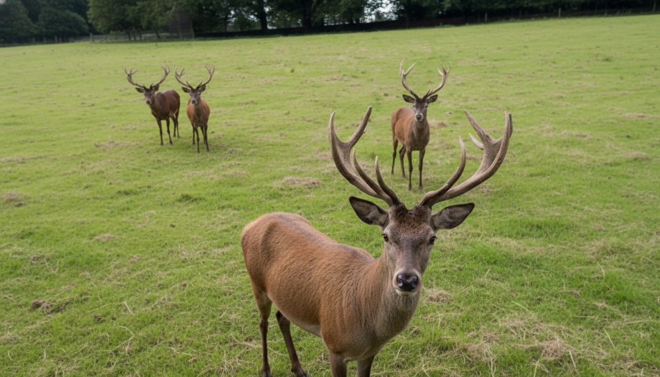
Rich biodiversity with tigers elephants wild buffaloes swamp deer and numerous bird species.,
UNESCO World Heritage Site status.,
Beautiful landscapes featuring grasslands wetlands and forests.,
Ideal destination for wildlife photography and birdwatching.
💡 Travel Tips
Best time to visit: November to April.,
Wear comfortable clothing in earthy colors.,
Carry binoculars and a camera.,
Book safari permits in advance during peak season.,
Follow park rules and maintain silence during safaris.,
Carry sunscreen hats and drinking water.,
Avoid visiting during the monsoon season when parts of the park may remain closed.
🌟 Special Features
World's largest population of Indian one-horned rhinoceroses.,
Part of the India Tiger Reserve network.,
Habitat for over 500 species of birds.,
Frequent sightings of elephants wild buffaloes and deer.,
Unique ecosystem shaped by annual Brahmaputra floods.

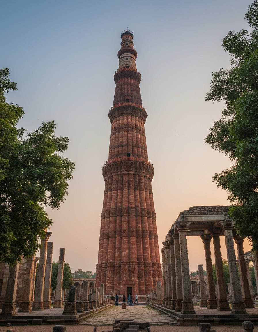
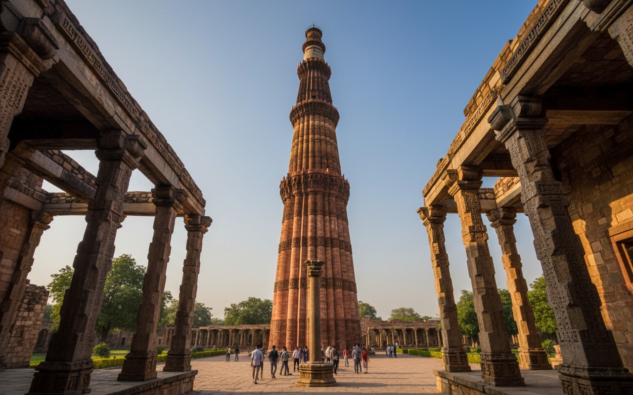
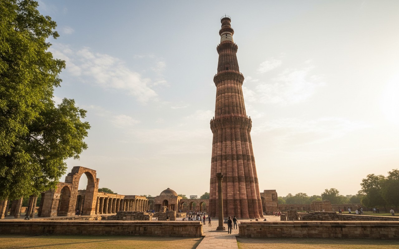
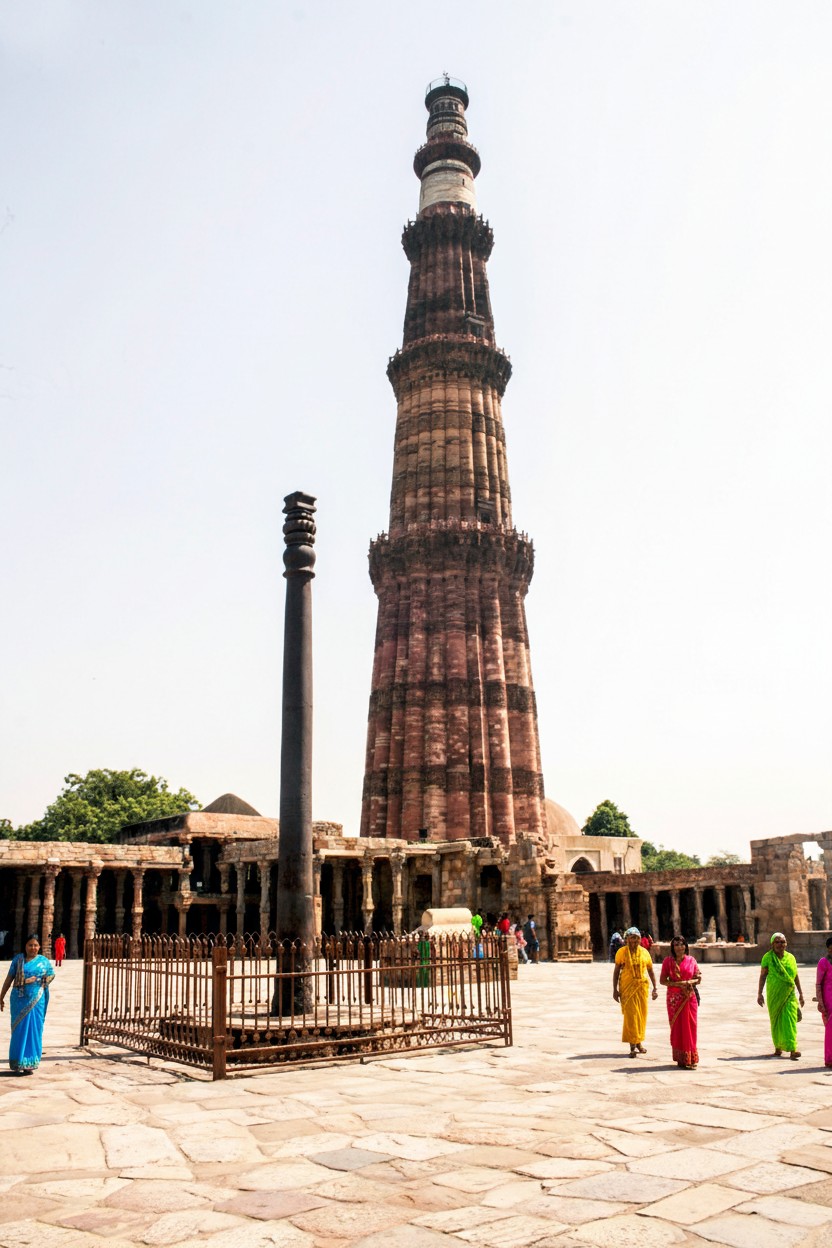
Qutub Minar
• South Delhi • Delhi
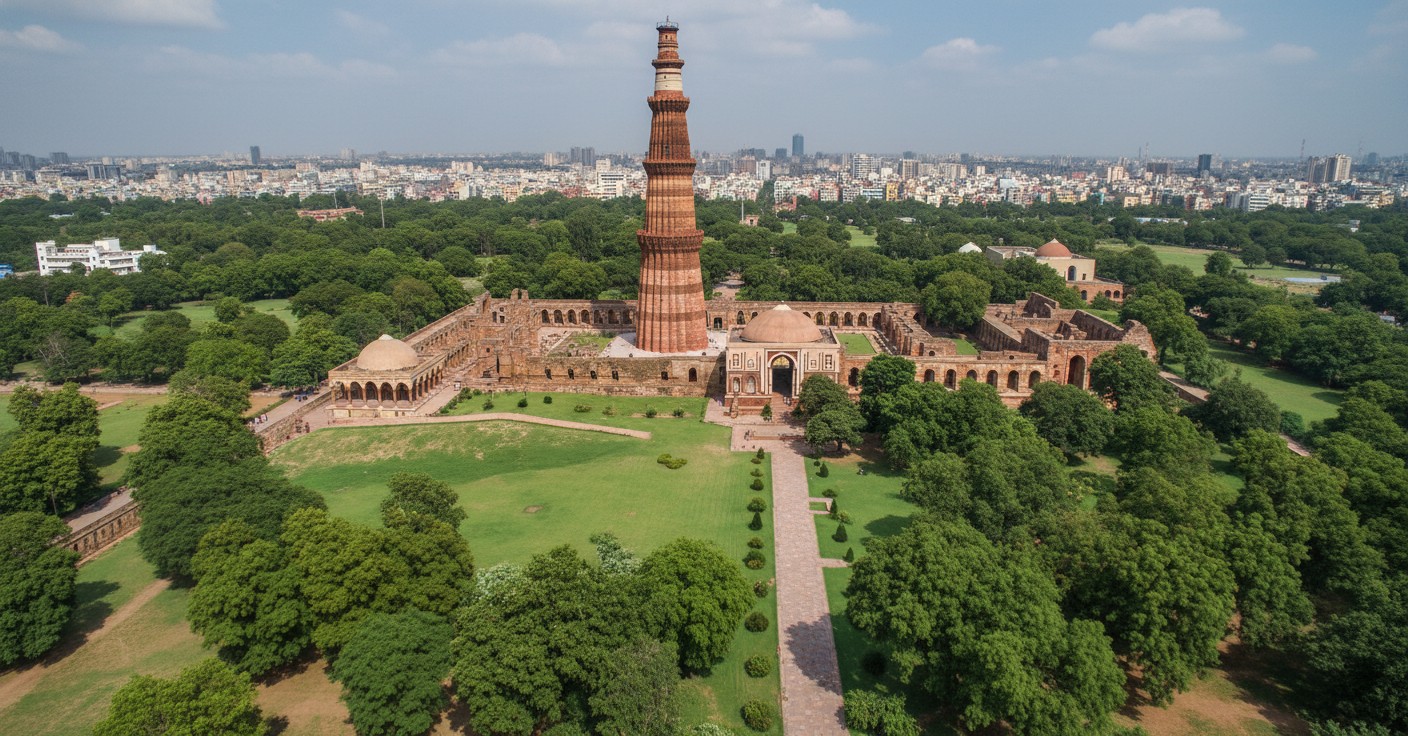
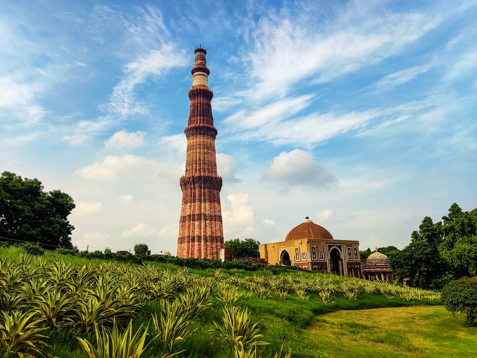
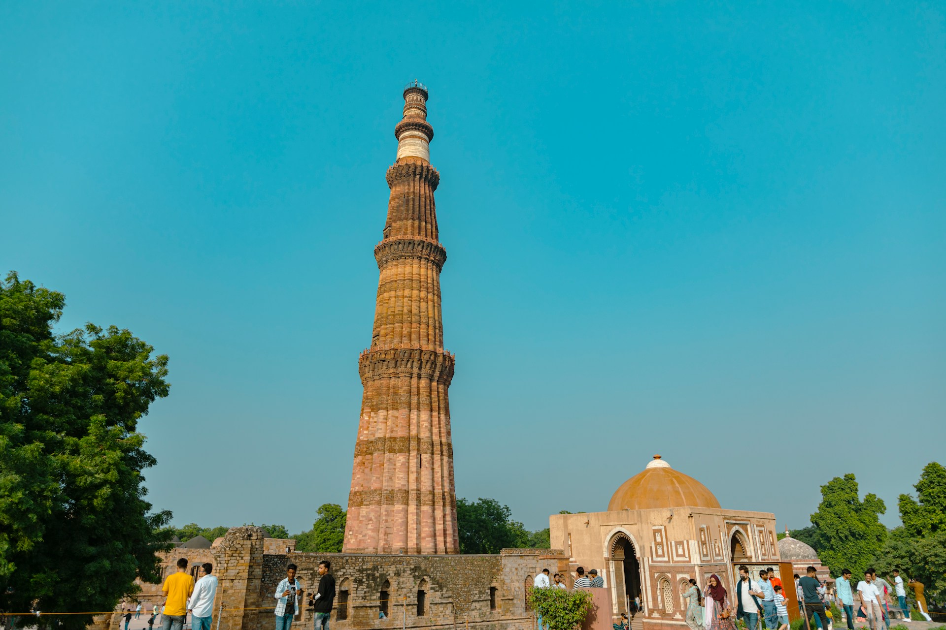
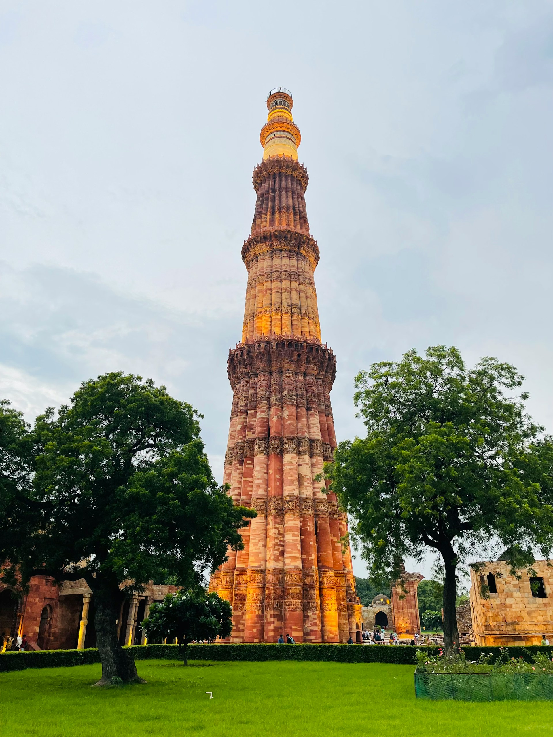
Qutub Minar is one of the most famous historical monuments in India and a symbol of Delhi's rich cultural heritage. Built in 1193 by Qutb-ud-din Aibak, the tower was later completed by his successors. Standing at a height of approximately 72.5 meters (238 feet), it is the tallest brick minaret in the world and is recognized as a UNESCO World Heritage Site. The monument showcases a remarkable blend of Indo-Islamic architecture with intricate carvings, Arabic inscriptions, and beautifully designed balconies.
Qutub Minar is one of India's most celebrated historical landmarks and a masterpiece of medieval architecture located in the Mehrauli area of Delhi. Constructed in 1193 by Qutb-ud-din Aibak, founder of the Delhi Sultanate, the monument was later expanded and completed by subsequent rulers. Rising to a height of 72.5 meters, Qutub Minar is the tallest brick minaret in the world and attracts millions of visitors every year.
Built primarily from red sandstone with sections of marble added later, the tower consists of five distinct storeys, each adorned with projecting balconies and intricate decorative bands. The surface of the monument is covered with beautiful carvings and Arabic inscriptions that reflect the artistic excellence of the period. The structure represents a remarkable blend of Islamic and Indian architectural styles.
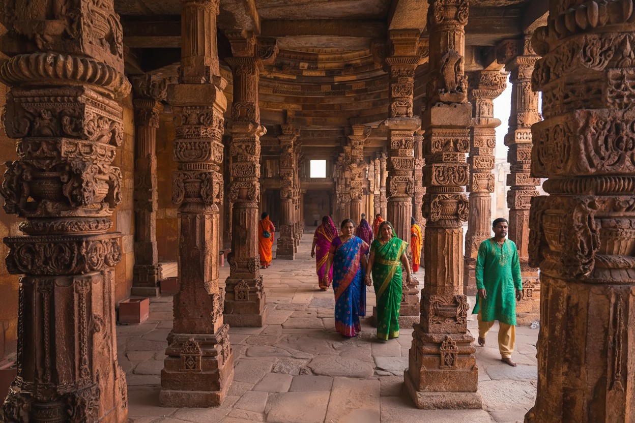
The Qutub Complex surrounding the minaret contains several significant historical monuments, including the Quwwat-ul-Islam Mosque, Alai Darwaza, Alai Minar, and the famous Iron Pillar, which has resisted corrosion for more than 1,600 years. These attractions make the complex a treasure trove of history and archaeology.
Recognized as a UNESCO World Heritage Site, Qutub Minar stands as a symbol of Delhi's rich past and cultural diversity. Visitors are captivated not only by its impressive height but also by the craftsmanship and historical importance it represents. The monument is especially beautiful during sunrise and sunset when the changing light enhances the color of the sandstone. For history lovers, architecture enthusiasts, photographers, and tourists, Qutub Minar offers an unforgettable glimpse into India's glorious heritage and remains one of the most visited monuments in the country.
🎯 Things to do
- Walk around the Qutub Minar complex and gardens
- See intricate carvings and inscriptions on the minaret surface
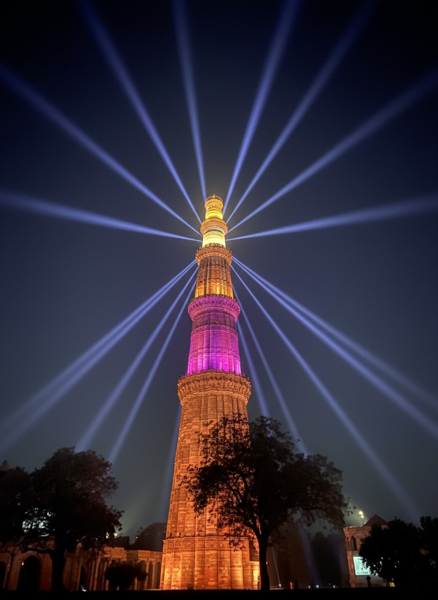
- Attend the Light & Sound Show (seasonal)
- Take photos & enjoy architectural details
- Join a heritage walk focusing on historical context and stories.
📍 Near By
- Mehrauli Archaeological Park Tour Guide – Extensive ruins & heritage trails
- Zafar Mahal – 19th-century palace ruins
- Hauz Khas Fort – Fort & urban village with cafes
- Tughlaqabad Fort Delhi – Ancient fort complex
- Safdarjung Tomb
- Delhi & Humayun’s Tomb – Mughal-era tombs worth a visit .
🛣️ How to Reach
By Air :-The nearest airport is Indira Gandhi International Airport located about 13 km away. Visitors can hire a taxi use app-based cab services or take the Delhi Metro from the airport to reach Qutub Minar.,
By Train :-The nearest major railway stations are:
New Delhi Railway Station – about 18 km away
Hazrat Nizamuddin Railway Station – about 15 km away
Taxis auto-rickshaws and metro services are readily available from these stations.
By Metro :-
The easiest way is via the Delhi Metro. Get down at Qutub Minar Metro Station on the Yellow Line. The monument is around 1.5 km from the station.,
By Bus :-Delhi Transport Corporation (DTC) buses and private buses operate regularly from different parts of Delhi to Mehrauli, where Qutub Minar is located.
⭐ Why Visit
UNESCO World Heritage Site.,
Tallest brick minaret in the world.,
Excellent example of Indo-Islamic architecture.,
Rich historical and cultural significance.,
Ideal destination for photography and history enthusiasts.,
Beautiful gardens and ancient ruins within the complex.
💡 Travel Tips
Visit early morning or late afternoon to avoid crowds and heat.,
Wear comfortable walking shoes.,
Carry water, especially during summer.,
Photography is allowed making it a great spot for capturing heritage architecture.,
Allocate at least 2–3 hours to explore the entire complex.,
The best time to visit is from October to March when the weather is pleasant.
🌟 Special Features
Height of 72.5 meters with 379 steps inside.,
Constructed using red sandstone and marble.,
Intricate Quranic inscriptions and carvings.,
Houses the famous Iron Pillar of Delhi known for its rust-resistant properties.,
Includes historic structures such as the Quwwat-ul-Islam Mosque and Alai Darwaza.
Tawang
• Tawang • Arunachal Pradesh
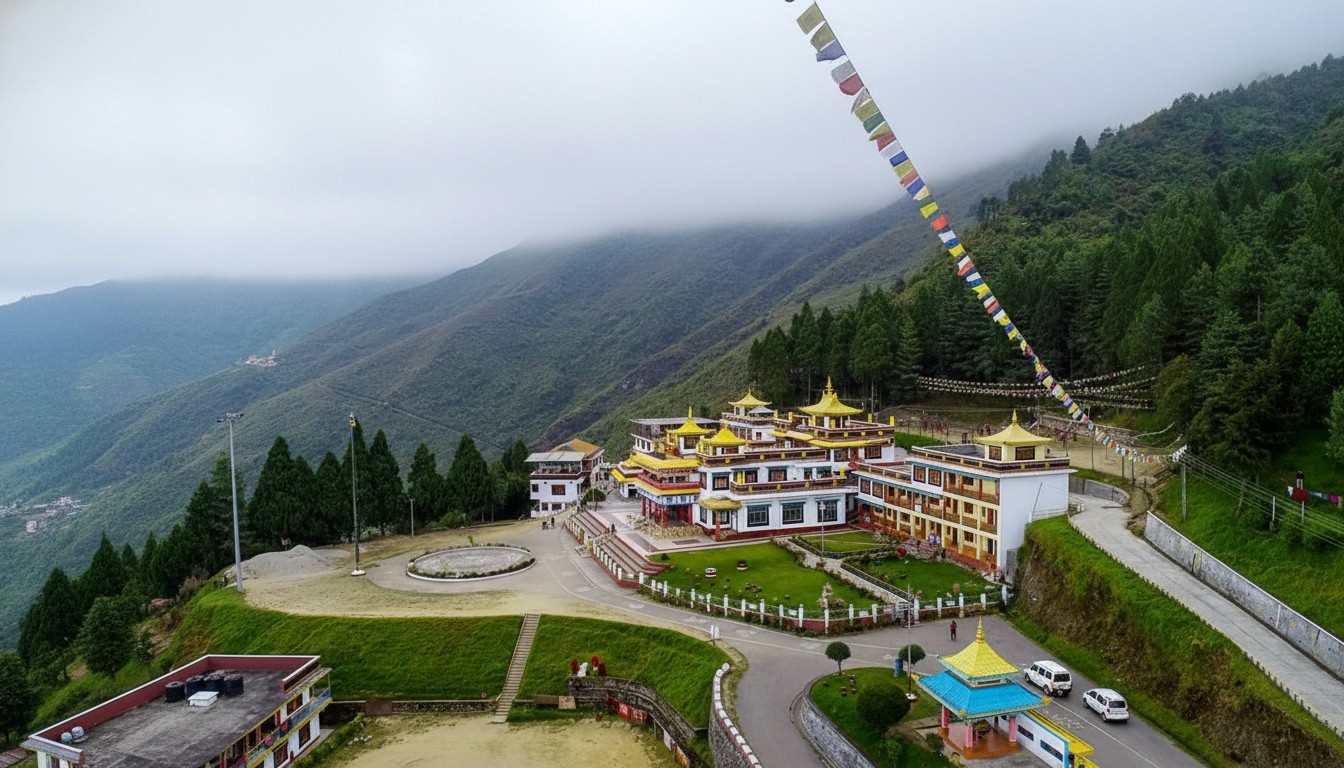
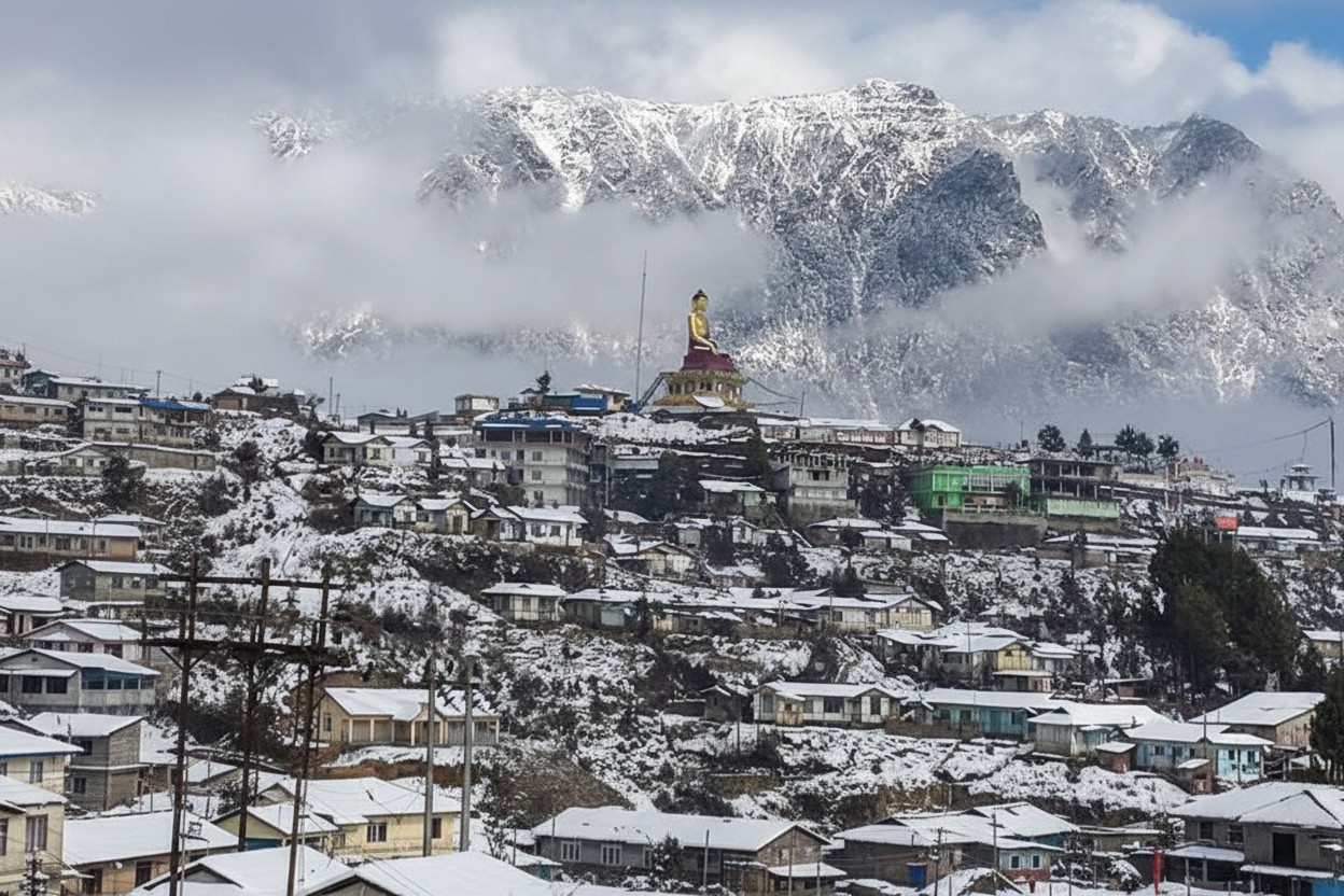
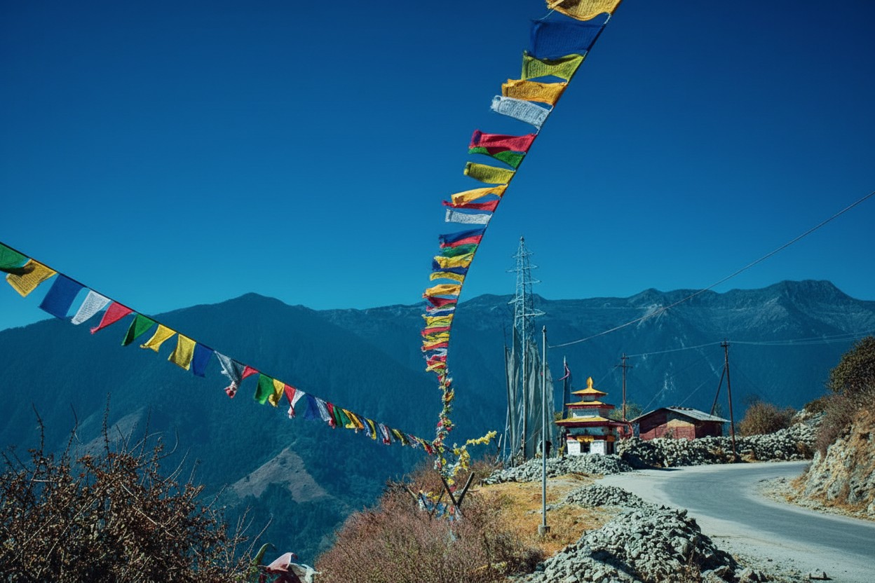
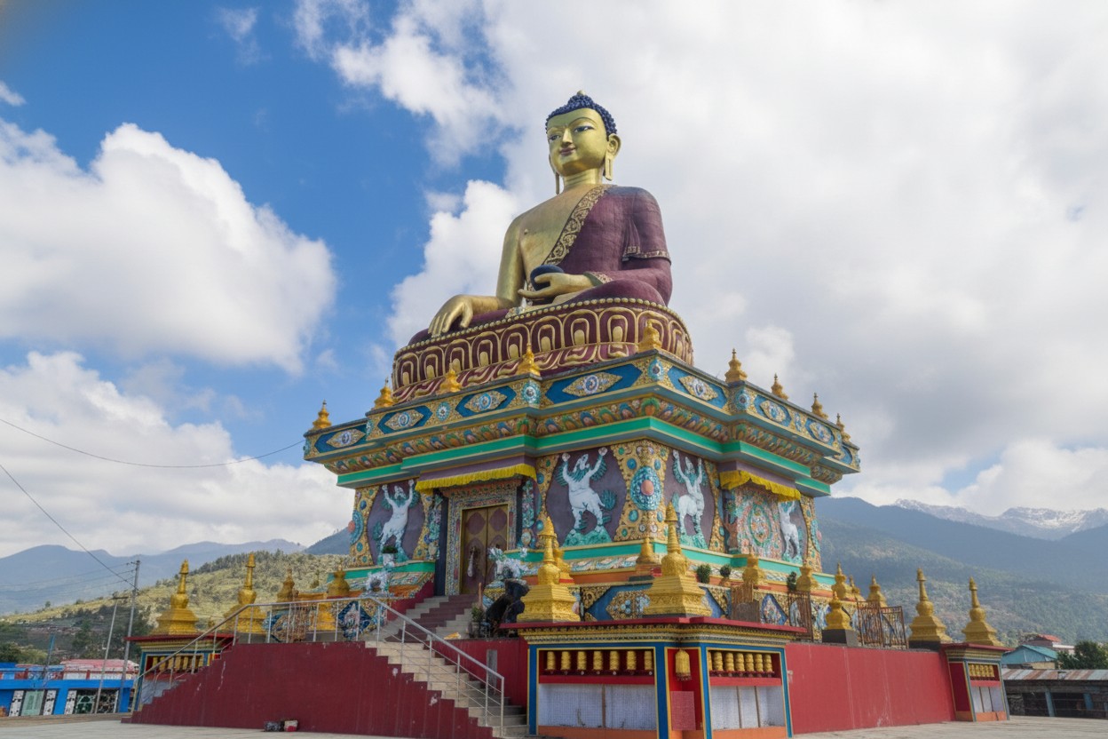
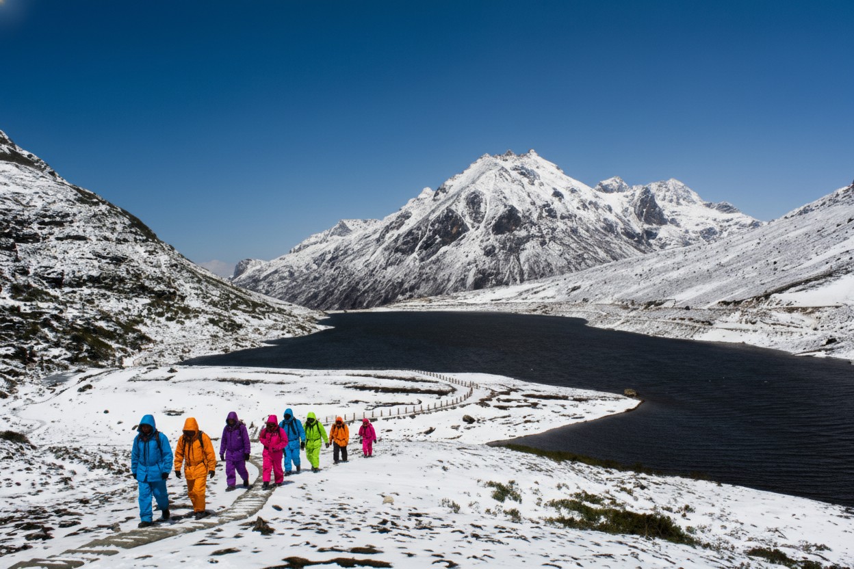
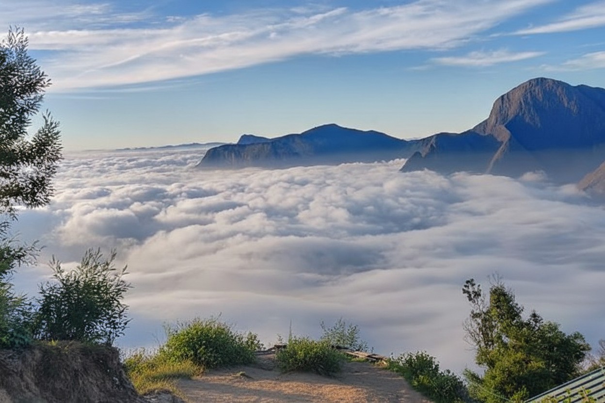
Tawang is a breathtaking hill town located in the northwestern part of Arunachal Pradesh at an altitude of about 3,000 meters above sea level. Surrounded by snow-capped Himalayan peaks, crystal-clear lakes, ancient monasteries, and lush valleys, Tawang is one of the most beautiful destinations in Northeast India. It is renowned for its rich Buddhist culture and is home to the famous Tawang Monastery, the largest monastery in India and one of the largest Buddhist monasteries in the world. The town offers a perfect blend of spirituality, history, adventure, and natural beauty.
Nestled amidst the majestic Eastern Himalayas, Tawang is one of the most enchanting destinations in Arunachal Pradesh. Located at an elevation of around 3,000 meters, this picturesque hill town is famous for its breathtaking landscapes, serene monasteries, pristine lakes, and vibrant Buddhist culture. Surrounded by snow-clad mountains and lush valleys, Tawang offers visitors an unforgettable experience of natural beauty and spiritual tranquility.
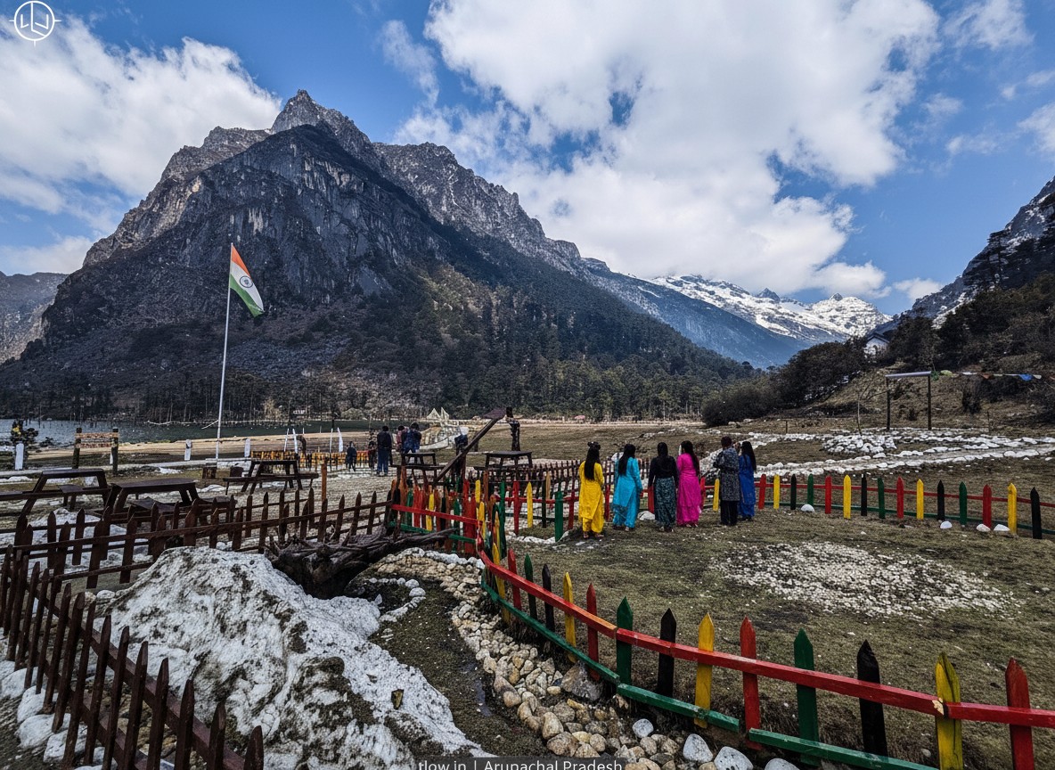
The town's most celebrated attraction is the Tawang Monastery, a 17th-century Buddhist monastery that stands as the largest monastery in India and one of the largest in the world. Its magnificent architecture, ancient scriptures, and peaceful atmosphere attract pilgrims and tourists from across the globe. Another highlight is Sela Pass, a high-altitude mountain pass surrounded by snow-covered peaks and beautiful lakes that create spectacular panoramic views.
Nature lovers can explore Sangetsar Lake, popularly known as Madhuri Lake, and admire the scenic Nuranang Waterfall, one of the most beautiful waterfalls in Northeast India. History enthusiasts can visit the Tawang War Memorial, which commemorates the brave soldiers who sacrificed their lives during the 1962 Indo-China War.
Tawang is also known for its unique Monpa culture, colorful festivals, traditional handicrafts, and warm hospitality. The local cuisine, rich traditions, and Buddhist heritage add a special charm to the destination. Whether visitors seek adventure, photography, spirituality, or relaxation, Tawang provides a perfect escape from the hustle and bustle of city life.
With its awe-inspiring scenery, rich cultural heritage, and peaceful environment, Tawang remains one of India's most remarkable mountain destinations and a must-visit place for anyone exploring the beauty of Northeast India.
🎯 Things to do
- Visit Tawang Monastery
- Explore Madhuri Lake (Sangestar Tso)
- Pay respects at Tawang War Memorial
- Enjoy snowfall and photography
- Experience Monpa culture and local cuisine
- Trekking and nature walks
- Visit high-altitude passes like Sela Pass
- Attend local Buddhist festivals ..
📍 Near By
- Tawang Monastery (0 km)
- Sela Pass (78 km)
- Madhuri Lake (Sangestar Tso) (35 km)
- Bum La Pass (37 km – permit required)
- Nuranang (Jang) Waterfall (40 km)
- Pankang Teng Tso Lake (PTSO) (15 km)
- Jaswant Garh War Memorial (25 km).
🛣️ How to Reach
By Air :-Nearest major airport: Lokpriya Gopinath Bordoloi International Airport (about 480 km away)
Alternative airport: Salonibari Airport (about 330–390 km away)
From Guwahati or Tezpur taxis and shared vehicles are available to Tawang.,
By Train :- Nearest railway stations:
Guwahati Railway Station
Rangapara North Railway Station
Continue the journey by road via Bomdila and Dirang.,
By Road / Bus :-Route: Guwahati → Bhalukpong → Bomdila → Dirang → Tawang.
Distance: Approximately 480–520 km
Travel Time: 14–16 hours
State-run and private buses shared Sumos and taxis operate regularly.,
By Helicopter :-Helicopter services occasionally operate between Guwahati and Tawang subject to weather conditions and availability.
⭐ Why Visit
Visit the magnificent Tawang Monastery.,
Experience the scenic beauty of Sela Pass.,
Explore the stunning Sangetsar Lake (Madhuri Lake).,
Witness the majestic Nuranang Falls.,
Visit the historic Tawang War Memorial.,
Enjoy snow-covered landscapes trekking photography and local Monpa culture.
💡 Travel Tips
Indian tourists need an Inner Line Permit (ILP) to enter Arunachal Pradesh.,
Carry warm clothing throughout the year; temperatures can drop suddenly.,
Acclimatize properly due to the high altitude.,
Keep extra travel days for weather-related delays.,
Mobile connectivity may be limited in remote areas.,
Travel slowly and consider an overnight stay in Dirang or Bomdila.,
Carry essential medicines and identity documents.
🌟 Special Features
India's largest Buddhist monastery.,
Spectacular Himalayan scenery.,
High-altitude lakes with crystal-clear water.,
Rich Monpa tribal culture and traditions.,
Strategic location near the India-China border.,
Snowfall during winter months.,
Peaceful environment ideal for nature lovers and spiritual seekers.
Munnar
Munnar • Idukki • Kerala
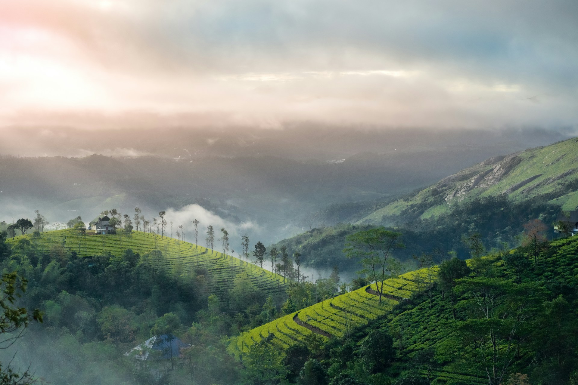
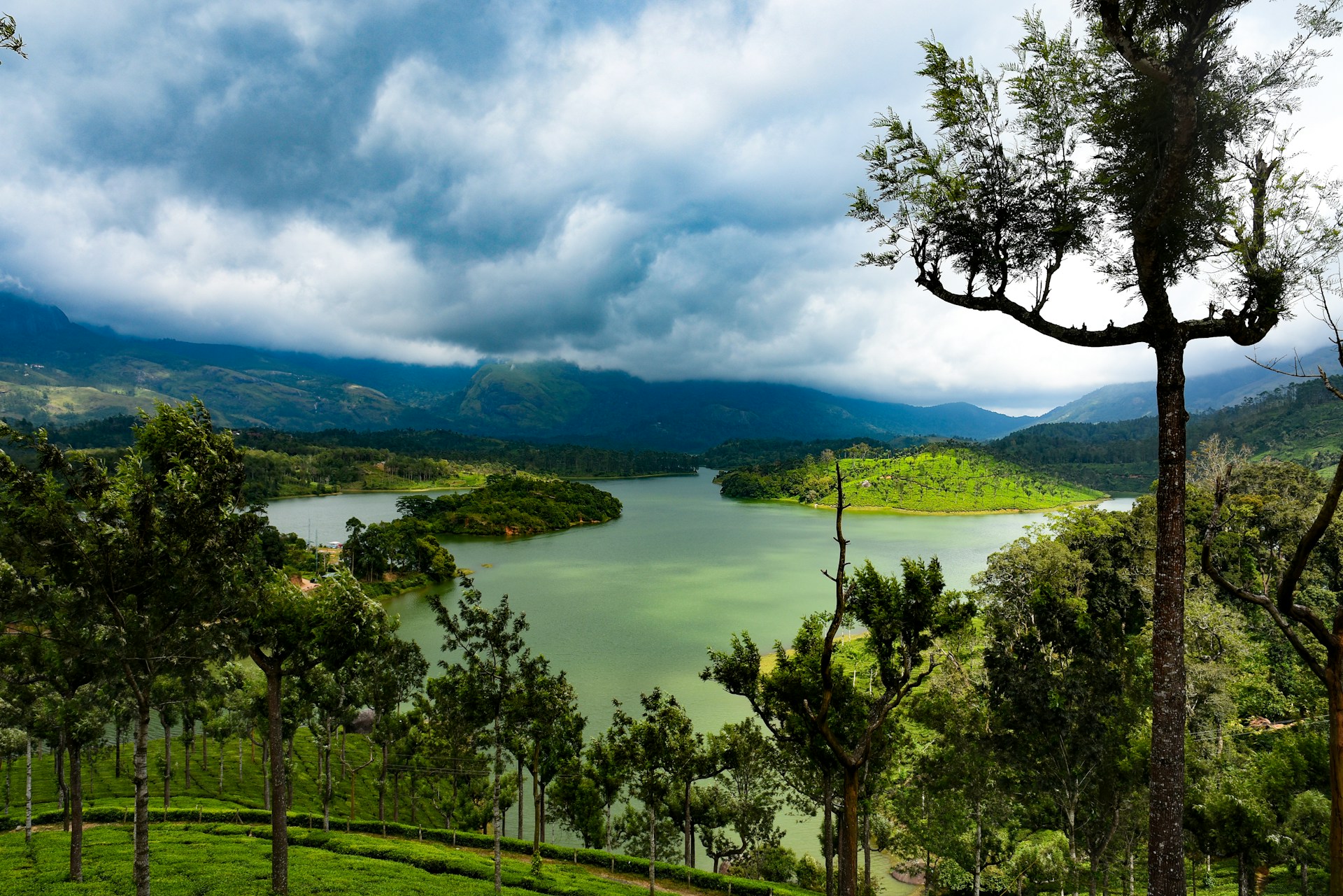
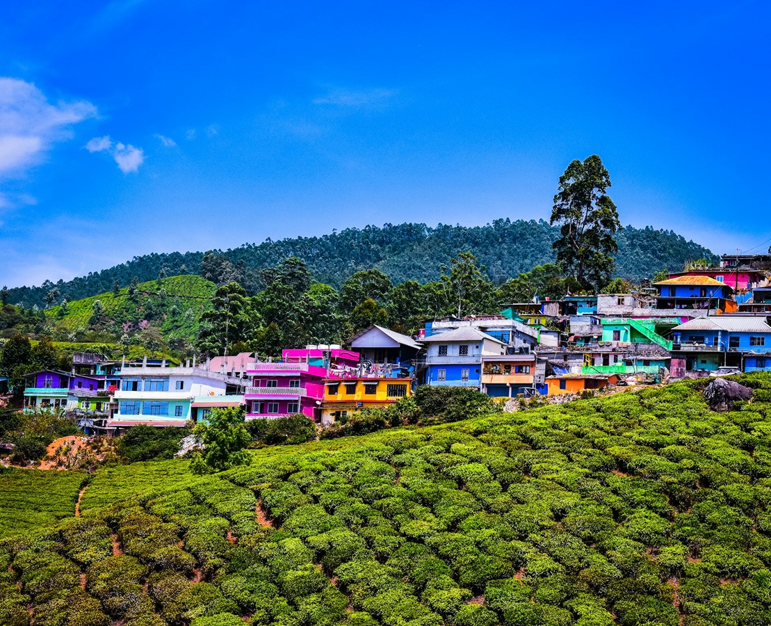
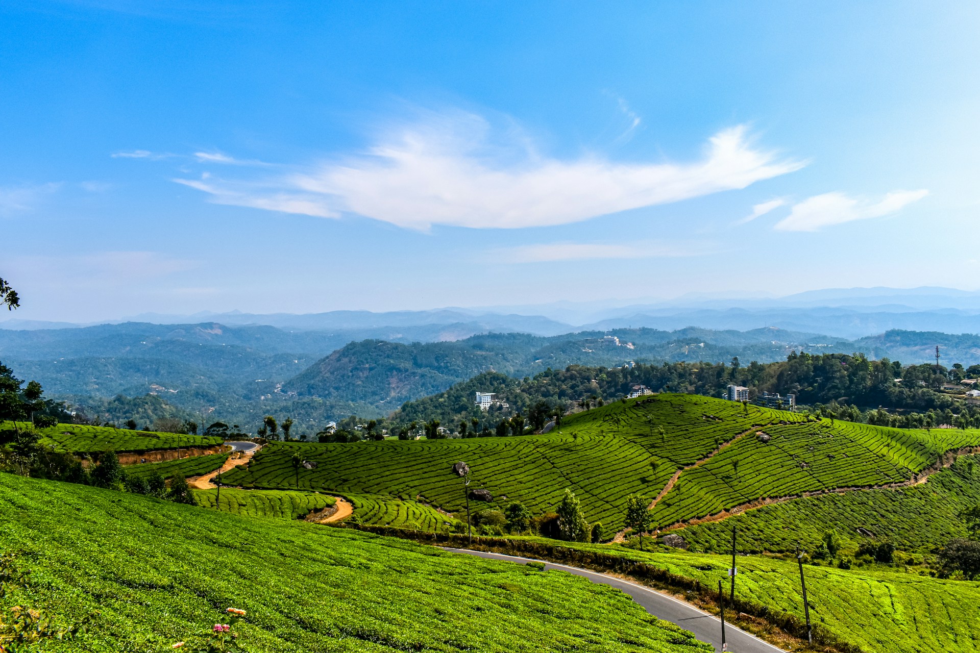
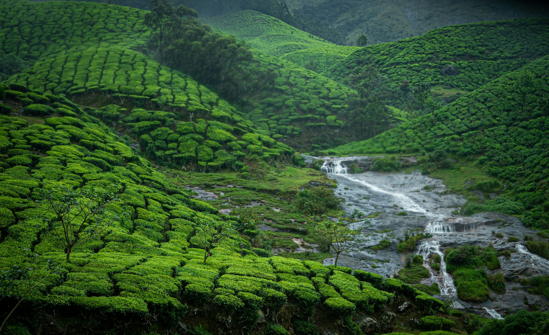
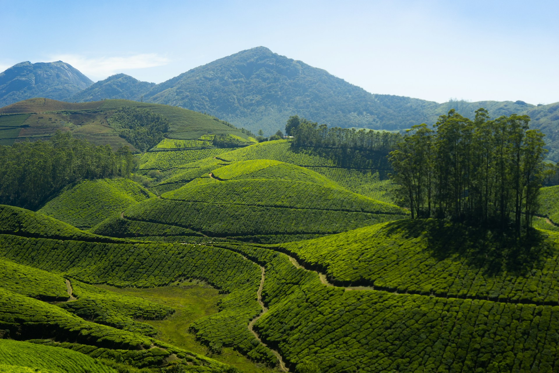
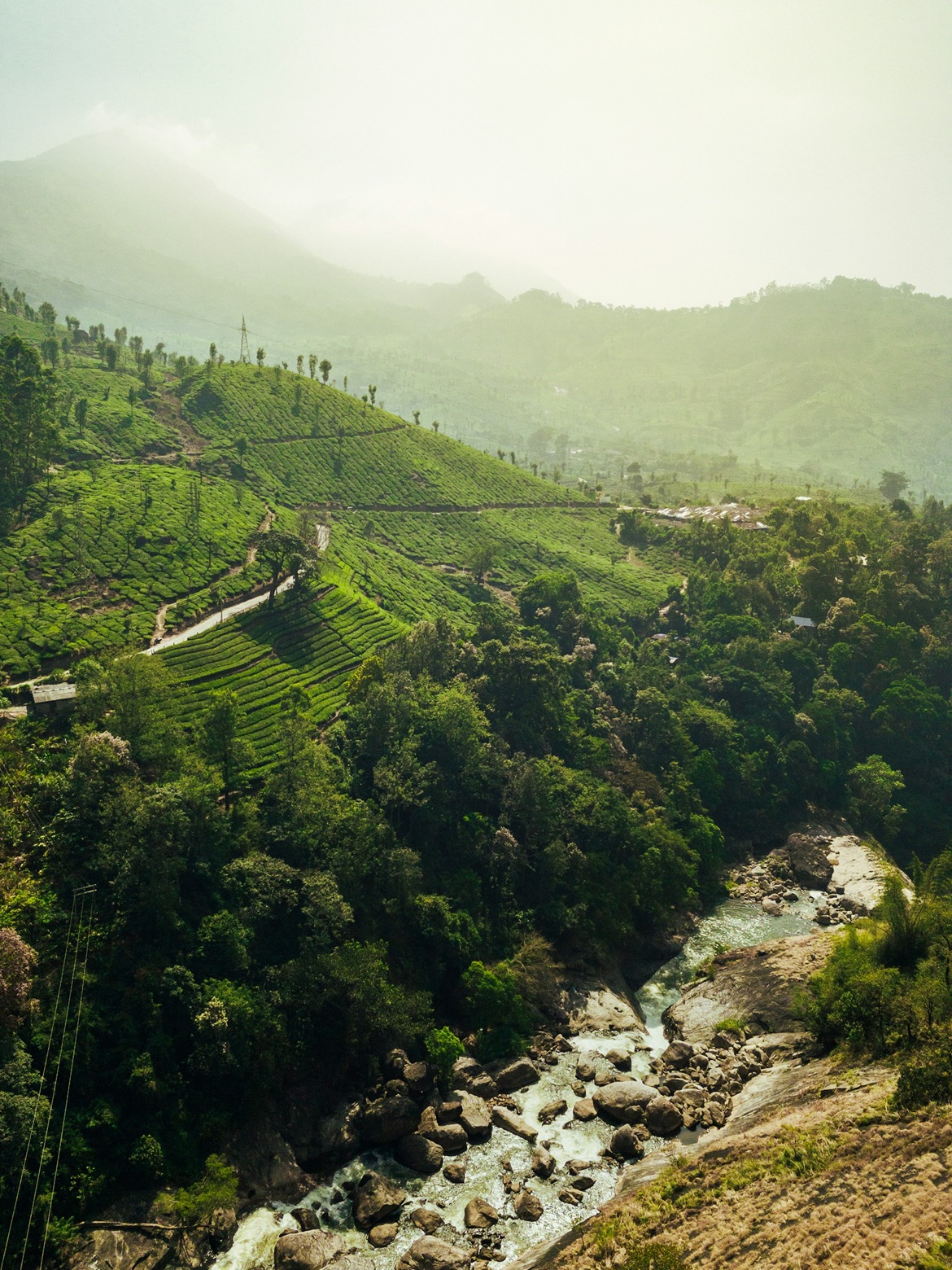
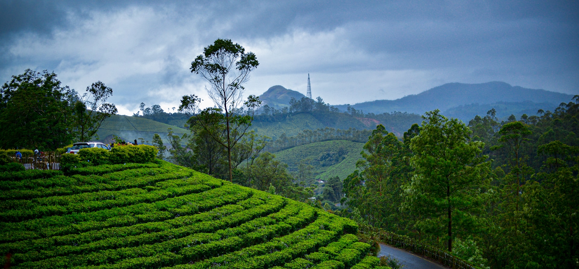
Munnar is one of Kerala's most beautiful hill stations, located in the Western Ghats at an altitude of about 1,600 meters above sea level. Famous for its endless tea plantations, mist-covered mountains, waterfalls, valleys, and cool climate, Munnar is often called the "Kashmir of South India." The name "Munnar" means "three rivers," referring to the confluence of the Mudhirapuzha, Nallathanni, and Kundala rivers. The town is a paradise for nature lovers, honeymooners, photographers, and adventure enthusiasts. Its lush green landscapes, fresh mountain air, and peaceful atmosphere make it one of the most visited tourist destinations in Kerala.
Munnar is a picturesque hill station nestled in the Western Ghats of Kerala and is among the most popular tourist destinations in South India. Situated at an elevation of approximately 1,600 meters above sea level, Munnar is renowned for its sprawling tea plantations, rolling hills, mist-covered valleys, and pleasant climate throughout the year. The town derives its name from the confluence of three mountain streams—Mudhirapuzha, Nallathanni, and Kundala—which flow through the region.
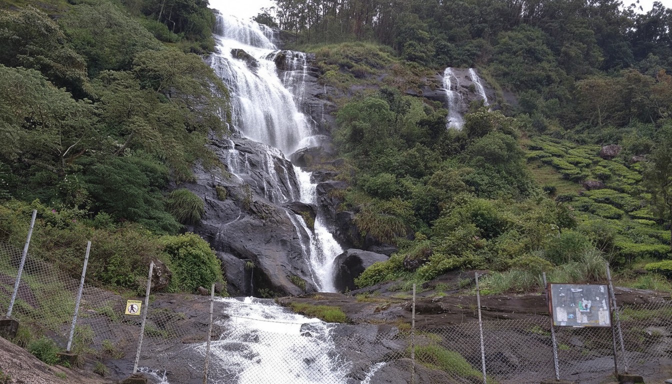
The landscape of Munnar is characterized by endless stretches of emerald-green tea gardens, dense forests, sparkling waterfalls, and winding mountain roads. Visitors are captivated by attractions such as Top Station, Eravikulam National Park, Mattupetty Dam, Echo Point, and Kundala Lake. The region is also famous for its rich biodiversity and is home to the endangered Nilgiri Tahr, a rare mountain goat species found in the Western Ghats.
Munnar offers a perfect blend of natural beauty, adventure, and relaxation. Trekking trails, wildlife exploration, boating, camping, and tea plantation visits provide memorable experiences for travelers of all ages. During the monsoon season, the hills become even more vibrant with lush greenery and cascading waterfalls, while winter brings cool temperatures and misty mornings.
One of Munnar's unique attractions is the Neelakurinji flower, which blooms once every twelve years and blankets the hills in a stunning shade of blue. The serene environment, fresh mountain air, and breathtaking scenery make Munnar an ideal destination for honeymooners, families, nature lovers, and photographers. Whether seeking adventure or tranquility, Munnar offers an unforgettable escape into the heart of Kerala's natural beauty.
🎯 Things to do
- Explore Tea Gardens & Tea Museum
- Visit Eravikulam National Park
- Enjoy views from Top Station
- Trekking at Meesapulimala
- Boating at Mattupetty Dam
- Photography and nature walks
- Wildlife spotting
- Visit spice plantations ..
📍 Near By
- Eravikulam National Park (15 km)
- Mattupetty Dam (13 km)
- Echo Point (15 km)
- Top Station (32 km)
- Kundala Lake (20 km)
- Anamudi Peak (Highest peak in South India)
- Attukad Waterfalls
- Chinnar Wildlife Sanctuary (60 km)
- ..
🛣️ How to Reach
By Air :-Nearest Airport: Cochin International Airport
Distance: Approximately 110–125 km from Munnar.
Travel Time: About 3–4 hours by taxi or bus.
Other nearby airports include Madurai Airport and Coimbatore International Airport.,
By Train :-Munnar does not have its own railway station.
Nearest railway stations:
Aluva Railway Station – about 110 km
Ernakulam Junction Railway Station – about 130 km
Taxis and buses are readily available from these stations.,
By Bus :-Regular Kerala State Road Transport Corporation (KSRTC) and private buses operate from Kochi Aluva Ernakulam Thrissur Madurai and other major cities.
Direct buses are available from Kochi and Aluva to Munnar.,
By Road
Kochi to Munnar: ~130 km (4 hours)
Madurai to Munnar: ~135 km (4–5 hours)
Coimbatore to Munnar: ~160 km (5 hours)
The drive through winding mountain roads tea gardens and waterfalls is a major attraction itself.
⭐ Why Visit
Vast tea plantations and tea museums,
Cool climate throughout the year,
Stunning viewpoints like Top Station,
Rich wildlife at Eravikulam National Park,
Beautiful waterfalls and lakes,
Trekking, camping, and nature photography,
Romantic destination for honeymooners,
Scenic mountain drives and sunrise views
💡 Travel Tips
Carry light woollen clothes especially during winter.,
Book hotels in advance during peak season (October–February).,
Start sightseeing early to avoid crowds.
Wear comfortable walking shoes for trekking and sightseeing.,
Carry rain protection during the monsoon season.,
Drive carefully on hilly roads with sharp bends.,
Keep cash available as some remote, areas may have limited digital connectivity.
🌟 Special Features
One of India's largest tea-growing regions.,
Home to the rare Neelakurinji flower which blooms once every 12 years.,
Rich biodiversity with endangered species like the Nilgiri Tahr.,
Spectacular sunrise and sunset viewpoints.,
Recognized internationally as a leading rural and eco-tourism destination.

Shri Mata Vaishno Devi
Katra • Reasi • Jammu and Kashmir
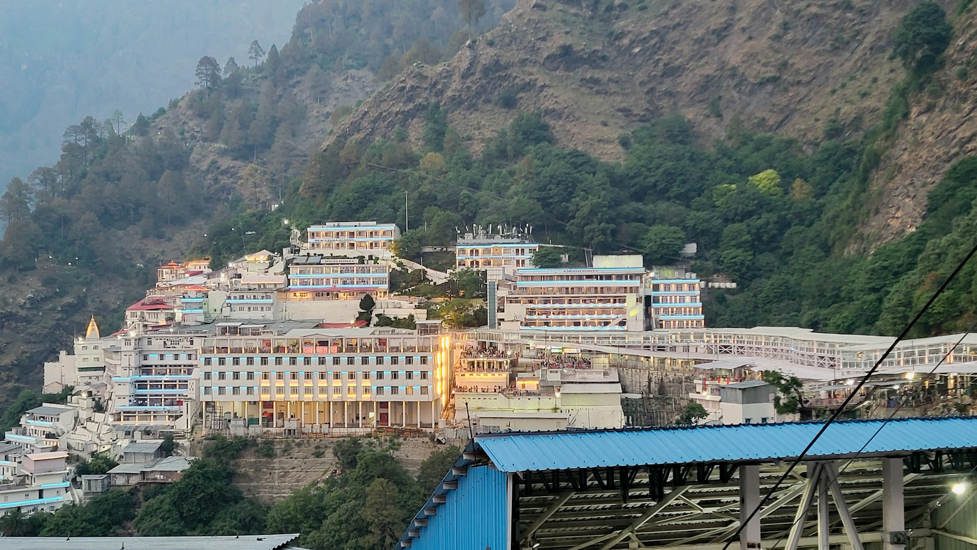
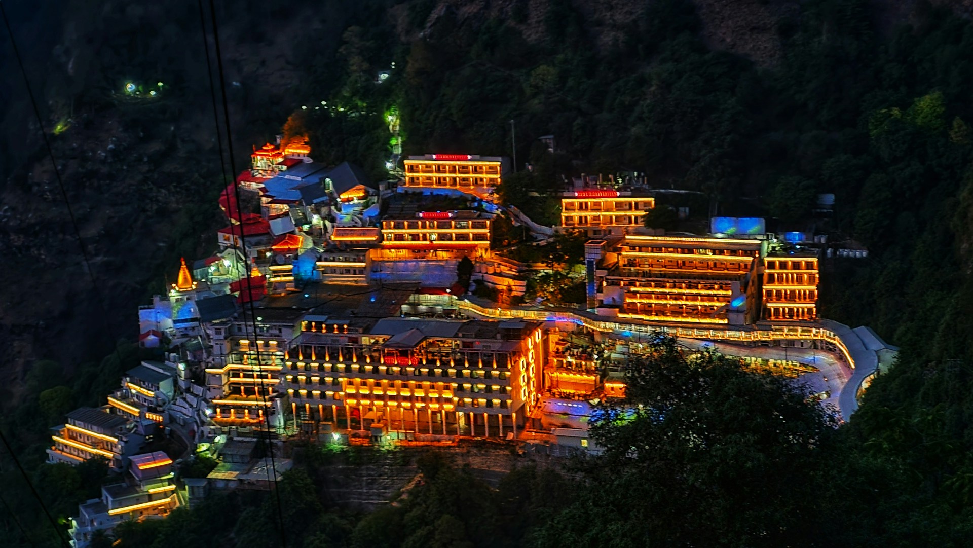
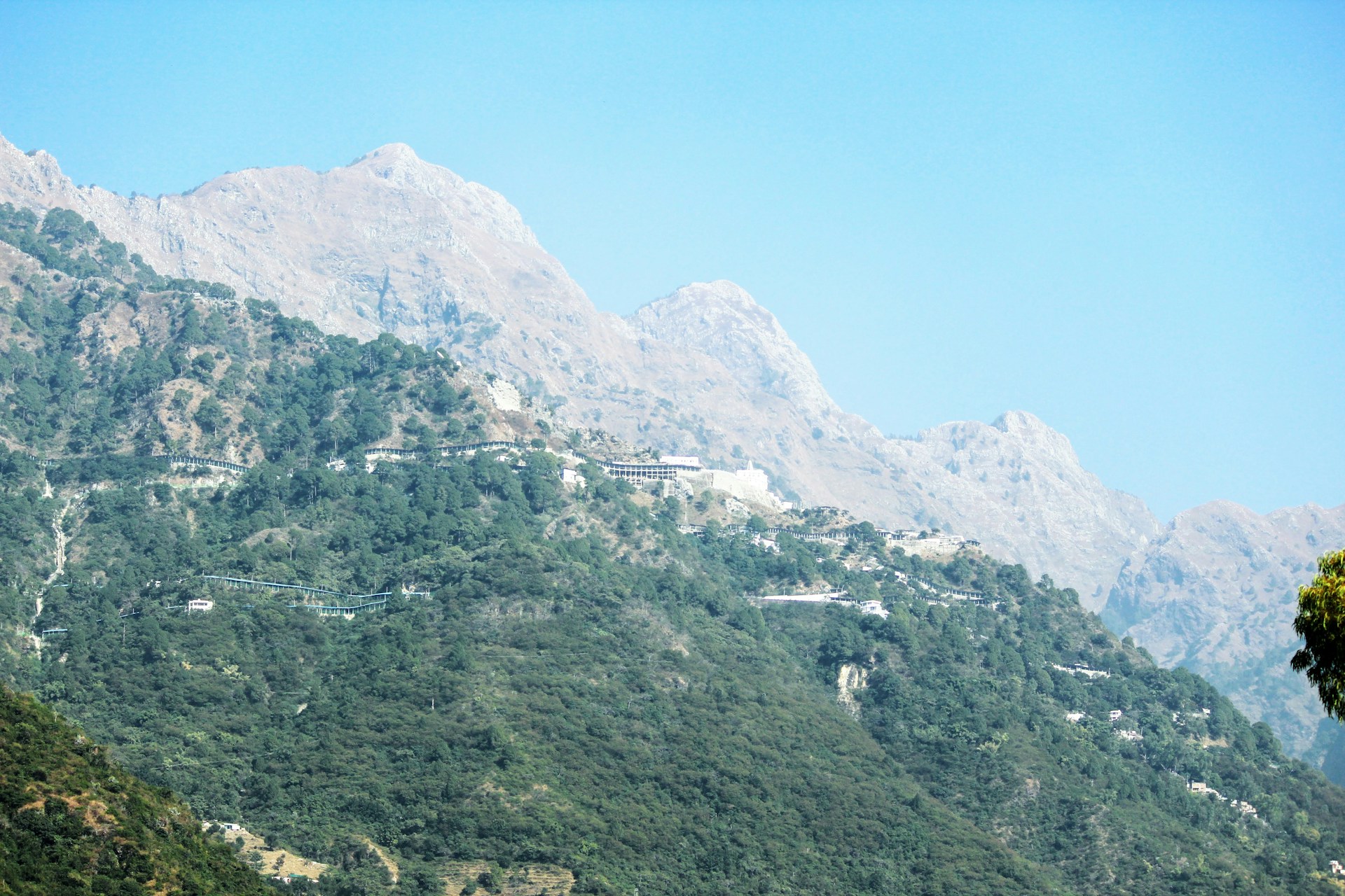
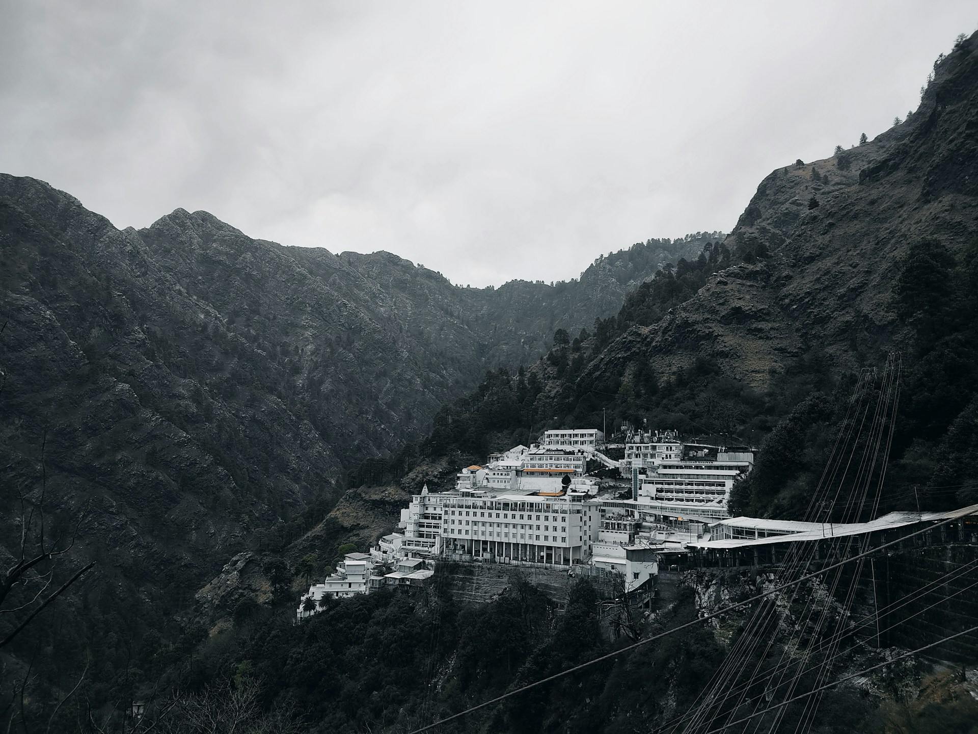
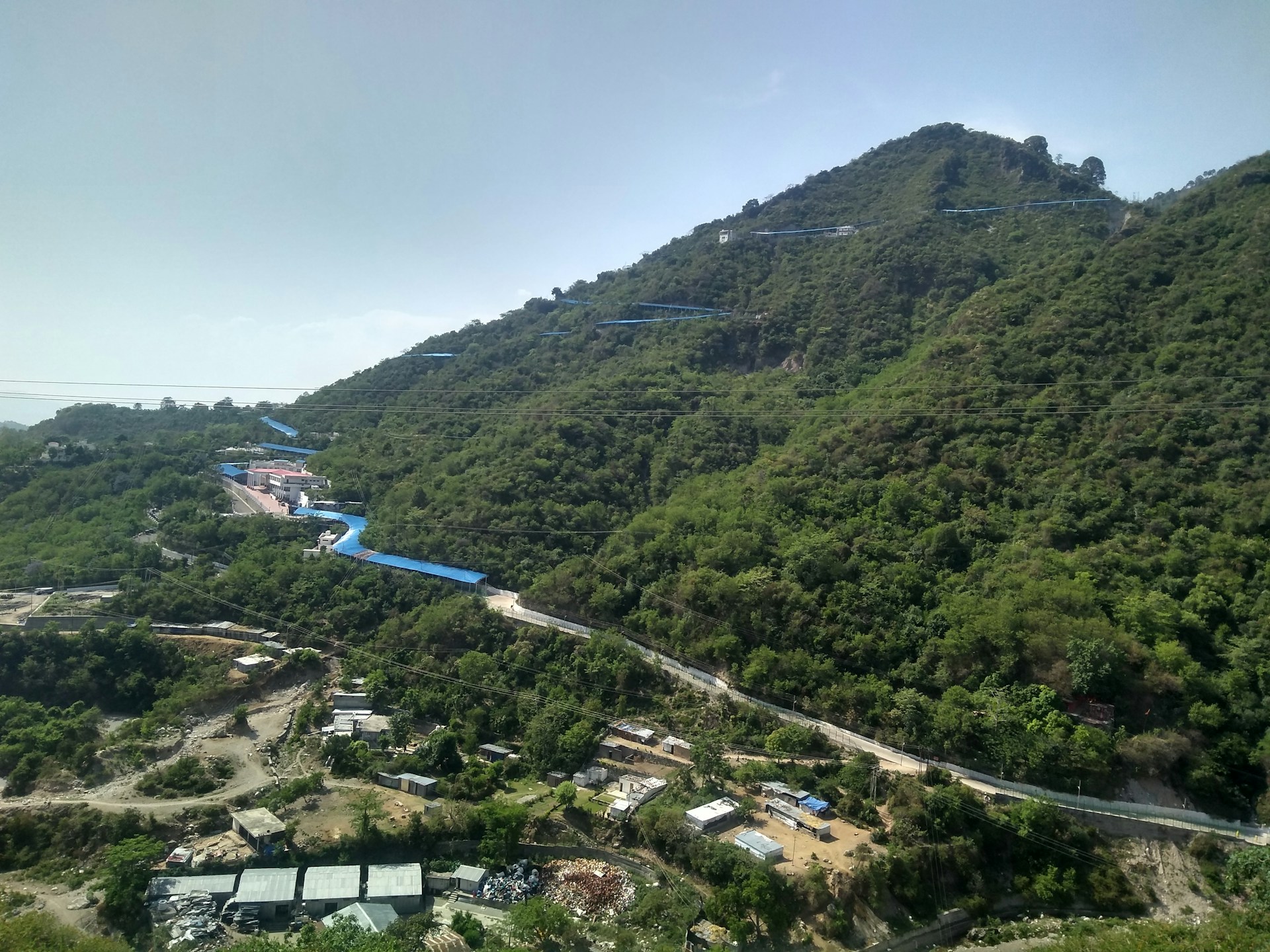
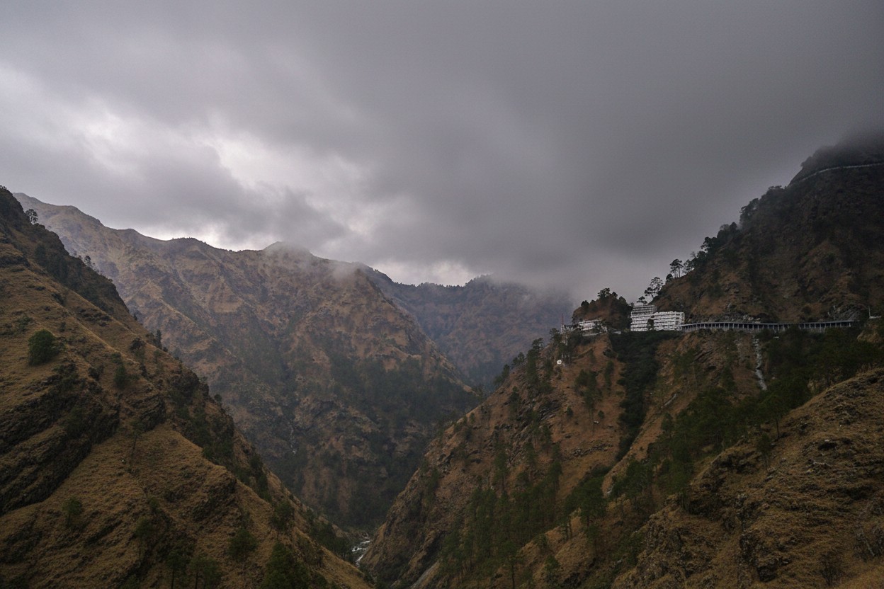
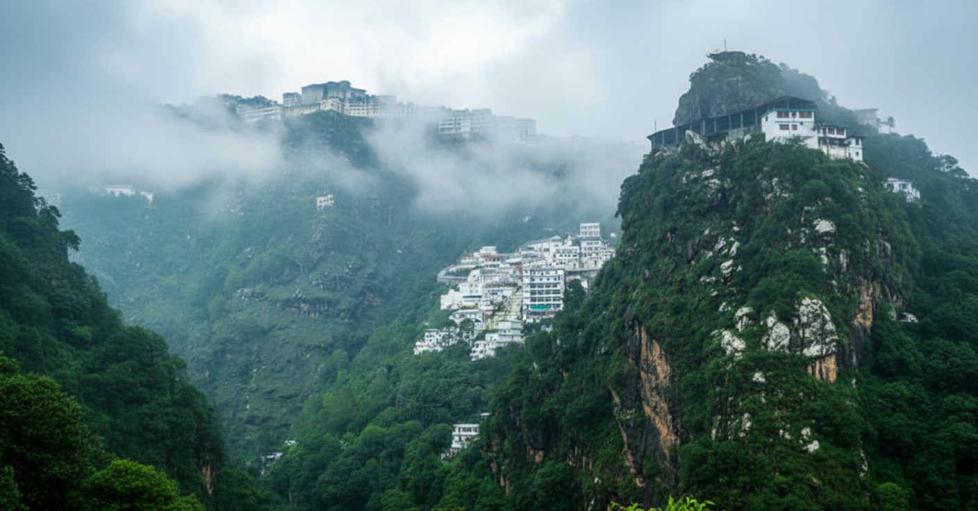
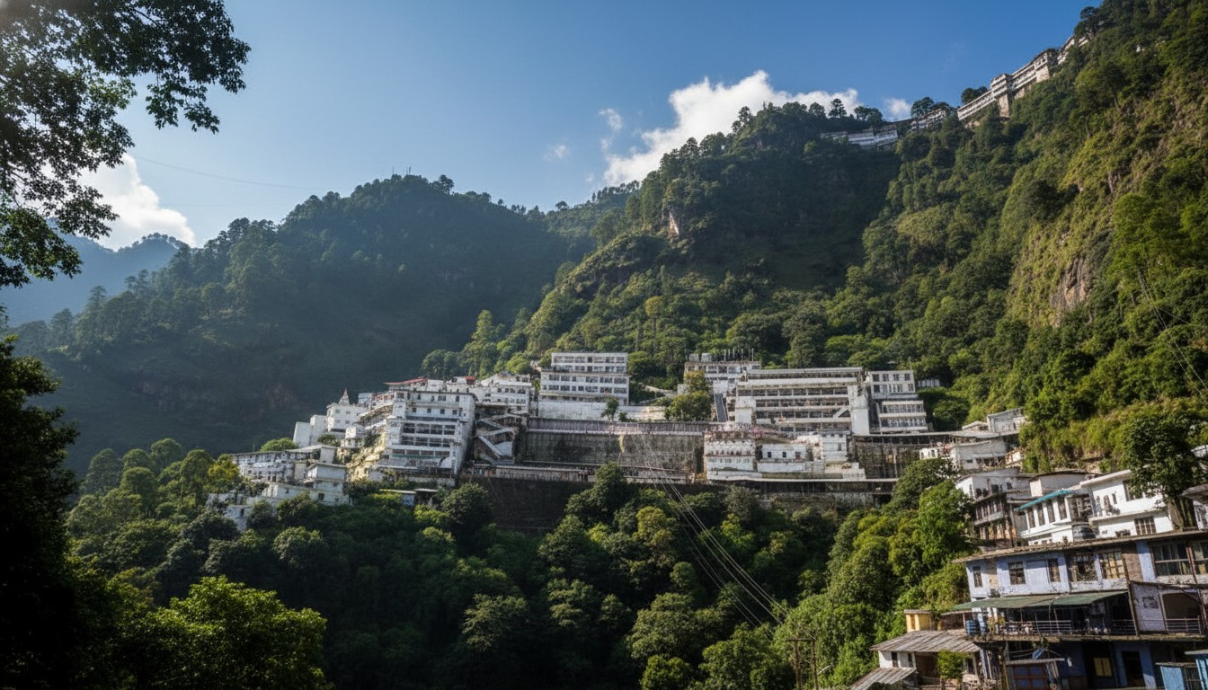
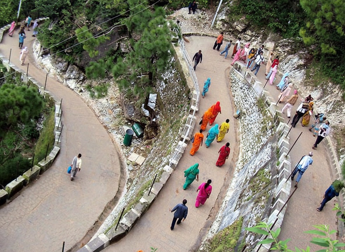
Shri Mata Vaishno Devi Shrine is one of the most revered Hindu pilgrimage sites in India. Situated in the Trikuta Hills near Katra, the shrine is dedicated to Goddess Vaishno Devi, who is worshipped as the combined manifestation of Mahakali, Mahalakshmi, and Mahasaraswati. The holy cave shrine is located at an altitude of about 1,585 meters (5,200 feet) above sea level and attracts millions of devotees every year. Pilgrims undertake a sacred trek of approximately 13 kilometers from Katra to the Bhawan, chanting “Jai Mata Di” throughout the journey.
Shri Mata Vaishno Devi is one of the most important and revered pilgrimage destinations in India. Located in the picturesque Trikuta Hills near Katra in Jammu and Kashmir, the shrine is dedicated to Goddess Vaishno Devi, who is worshipped as the embodiment of divine feminine power. Every year, millions of devotees from across the country and abroad undertake the sacred journey to seek the blessings of the Mother Goddess.
The pilgrimage begins at Katra, the base camp of the yatra. From there, pilgrims travel approximately 13 kilometers through a well-maintained mountain route to reach the holy Bhawan. The journey itself is considered an act of devotion and faith. Along the route, devotees visit important landmarks such as Banganga, Charan Paduka, Ardhkuwari, and Sanjichhat. The atmosphere is filled with spiritual energy as pilgrims chant “Jai Mata Di” while ascending the hills.
The main attraction of the shrine is the sacred cave, where the Goddess is worshipped in the form of three natural rock formations known as Pindis. These represent Mahakali, Mahalakshmi, and Mahasaraswati, symbolizing strength, wealth, and wisdom. The shrine's serene surroundings, combined with breathtaking views of the mountains, create a unique blend of spirituality and natural beauty.
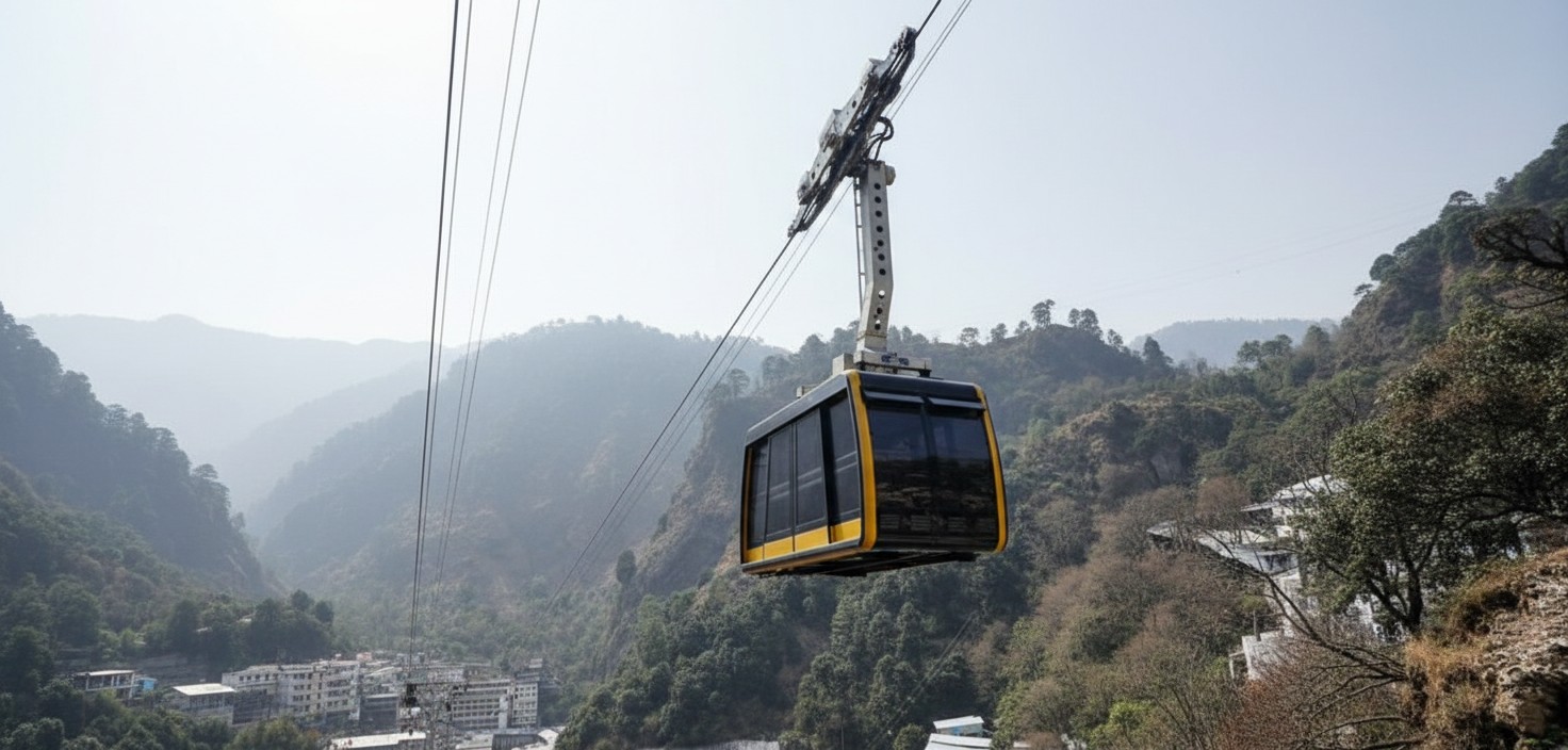
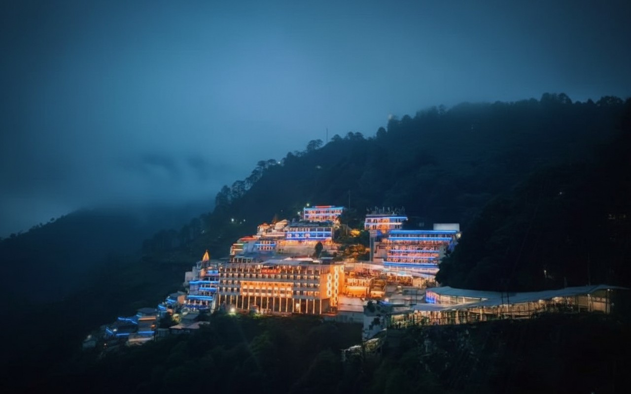
In addition to its religious significance, the shrine offers modern facilities for visitors, including accommodation, food courts, medical assistance, battery cars, and helicopter services. The yatra is accessible throughout the year, though Navratri is considered especially auspicious.
A visit to Shri Mata Vaishno Devi is more than a pilgrimage; it is a journey of faith, devotion, and self-discovery. The experience leaves devotees with a deep sense of peace, fulfillment, and spiritual upliftment, making it one of the most cherished religious destinations in India.
🎯 Things to do
- Holy trek from Katra to Bhawan
- Darshan of Mata Vaishno Devi
- Visit Ardhkuwari Cave
- Trek to Bhairon Nath Temple
- Enjoy panoramic views from Himkoti
- Experience spiritual aartis and bhajans .
📍 Near By
- Bhairon Nath Temple (2 km from Bhawan)
- Ardhkuwari Cave /Himkoti View Point / Shiv Khori Cave (approx. 70 km)
- Patnitop Hill Station (approx. 80 km)
- Banganga Temple .
🛣️ How to Reach
By Air :- Nearest airport: Jammu Airport
Distance from airport to Katra: approximately 50 km.
Regular flights connect Jammu with major cities such as Delhi Mumbai and Chandigarh.
Taxis and buses are available from the airport to Katra.,
By Train :- Nearest railway station: Shri Mata Vaishno Devi Katra Railway Station
Direct trains are available from Delhi Mumbai Kolkata Ahmedabad and other major cities.
Alternatively travelers can arrive at Jammu Tawi Railway Station and continue to Katra by road.,
By Road :- Katra is well connected by national highways.
Regular bus services operate from Jammu Delhi Amritsar and other North Indian cities.
Private taxis and tourist coaches are also available.,
From Katra to Bhawan
Trek (13 km)
Pony (Horse)
Palki
Battery Car (on selected routes)
Helicopter service up to Sanjichhat, followed by a short walk to the shrine.
⭐ Why Visit
One of India's most sacred Shakti Peeth pilgrimage destinations.,
Spiritual atmosphere amidst the beautiful Trikuta Mountains.,
Holy cave containing the three natural Pindis representing the Divine Mother.,
A journey believed to fulfill devotees' wishes and bring peace faith and blessings.,
Scenic mountain views and well-developed pilgrimage facilities.
💡 Travel Tips
Register for the Yatra before starting the trek.,
Carry warm clothing, especially during winter and night travel.,
Wear comfortable walking shoes.,
Keep water and light snacks handy.,
Book accommodation and helicopter tickets well in advance during peak seasons and Navratri.,
Avoid carrying excessive luggage during the trek.,
Follow Shrine Board instructions and safety guidelines.
🌟 Special Features
Sacred cave shrine with three naturally formed Pindis.,
Open throughout the year.,
Modern facilities including battery cars accommodation medical aid and helicopter services.,
Beautiful trekking route passing through Banganga Charan Paduka Ardhkuwari and Sanjichhat.,
One of the most visited pilgrimage destinations in India.